
Weather authorities have escalated warnings across Wales as forecasters predict extreme rainfall that could pose serious flooding risks throughout Monday.
The Met Office has extended its amber-level alert for South Wales, cautioning that the deluge may create life-threatening conditions. The warning remains active for the entire day Monday, from midnight through late evening.
Unprecedented Rainfall Expected
Meteorologists are forecasting extraordinary precipitation levels, with the highest elevations in Wales potentially receiving up to 120mm of rainfall within a single 24-hour period. Most areas can expect between 20mm and 40mm, while hillier terrain may see accumulations reaching 80mm.
To put this in perspective, Wales typically receives 162mm of rain during the entire month of November. This month has already delivered approximately 240mm, making the incoming storm particularly concerning given the already waterlogged ground.
Across England and Wales combined, rainfall has reached 143% of normal levels for this time of year.
Heightened Landslide Concerns
The British Geological Survey has raised alarms about potential landslides, noting that historical data shows rainfall of this magnitude has previously triggered slope failures in Welsh terrain. Both natural hillsides and constructed embankments face increased risk, especially with soil already saturated from recent weather.
Additional Weather Hazards
Strong southerly and south-westerly winds will compound the rainfall’s impact, with gale-force conditions likely along coastal areas and elevated terrain. This combination of wind and rain increases the potential for widespread disruption.

Broader Alert Zones
Beyond the amber warning zone, yellow weather alerts have been issued for:
- Parts of south-west and north-west England (midnight Monday through 3am Tuesday)
- Central and northern Wales (same timeframe)
- South-west Scotland (midnight through 9pm Monday)
These yellow warnings indicate possible transportation delays, power interruptions, and isolated flooding incidents.
Potential Impacts
Officials are preparing for multiple scenarios, including:
- Residential and commercial property flooding
- Transportation cancellations and route closures
- Electrical service disruptions
- Communities potentially isolated by impassable roads
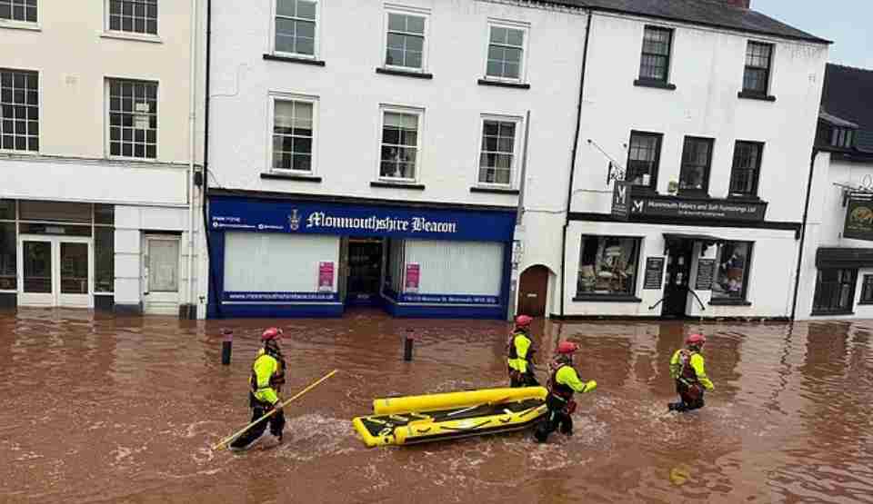
Natural Resources Wales has activated 34 flood alerts across southern regions, while the Environment Agency has issued three alerts expecting flooding and 42 warnings indicating flooding is possible.
Safety Recommendations
Richard Preece, tactical manager for Natural Resources Wales, urged residents to take immediate precautions: “With waterways already swollen and ground conditions saturated, we anticipate numerous flood warnings throughout the day. We strongly advise people to stay away from river banks and under no circumstances should anyone attempt to drive or walk through floodwater.”
Met Office senior meteorologist Marco Petagna emphasized that while Scotland and Northern Ireland have also experienced above-average rainfall, Monday’s weather event will primarily impact England and Wales. He noted that forecast conditions are expected to improve by Tuesday and Wednesday, with brighter, more scattered precipitation patterns returning.
Weather officials are focusing attention on Monday’s storm to ensure residents recognize the severity of the situation and take appropriate safety measures.